
Finding Records Along Farragut Streets
The most reliable Farragut street directory trail begins with the physical parcel, not a list of names. KGIS Maps can find an official address point, then display the parcel, owner and address report, acreage, subdivision, ward, school zones, and political districts. Its address geocoder works from county address points rather than a simple number range. Begin without adding a city, state, or ZIP, then choose from the result list if the match is not automatic.
- Enter the house number and street in KGIS. Save the situs address, parcel ID, legal-description clue, and subdivision before moving to another record.
- Open the owner or property report and compare the parcel with the Knox County Property Lookup. The assessor portal was under maintenance when reviewed, so its full live field list should not be assumed.
- Use the owner, legal description, and approximate recording date to request the purchase instrument from the Knox County Register of Deeds.
- For a current registration question, use the identity-based Tennessee Voter Lookup, then contact the Knox Election Commission if a match needs confirmation. It is not a street-browse roll.
- For former households, use the McClung directory and telephone-book holdings. The historical volumes are described in the Farragut City Directory collection.
Keep each result in a log with the address searched, source, date, parcel identifier, report or book page, and next custodian. A parcel owner can be a useful lead, but it does not establish every person who lives at that address.
Farragut Street Directory Sources by Address
Address-keyed sources serve different roles in Farragut. KGIS identifies the parcel and its map context. The assessor provides current assessment material. The Register of Deeds preserves the legal instrument trail, while Town permit reports add dated activity at an address. The voter lookup is designed to match a known person, county, and birth month and year, not to reveal a full block.
| Address record | Custodian | Useful detail | Access route |
|---|---|---|---|
| Parcel report | KGIS | Parcel shape, owner/address report, deed clues, districts | Free map viewer |
| Assessment record | Knox County Property Assessor | Owner, situs, mailing address, values, characteristics | Property Lookup, subject to live portal availability |
| Recorded instrument | Knox County Register of Deeds | Deeds, liens, plats, easements, legal description | Office or deed-copy request |
| Tax account | Knox County Trustee | Payment and delinquency path for a parcel account | Address or account route |
| Permit activity | Town of Farragut | Address-keyed project timing and printed report labels | Annual PDF reports |
| Court file or index | Knox County clerks | Party or case material when an address appears in a filing | Name or case search, not street browsing |
| Historic directory entry | McClung Collection | Past address, relationship, occupation, or subscriber line | Reference collection |
Read the columns as a chain rather than as competing answers. The map’s parcel ID and legal-description clues help the Register locate a document; a printed directory entry can help locate an earlier name or street spelling. The Knox County Trustee route concerns the tax account and payment path, not a resident list. Town reports are dated address evidence, but their printed applicant or contractor label is not automatically an owner or resident label.
Note: A mailing address may differ from the parcel situs for ordinary administrative reasons and should not be treated as proof of occupancy.
KGIS Tools for Farragut Street Searches
KGIS supplies the most complete verified search controls for a Farragut street directory inquiry. Owner names are stored in Last Name - First Name order and a broad owner search stops at 400 results. Advanced Address can load house numbers after a street choice, and an available unit can further narrow the result. Parcel identifiers must retain their zeros and spaces, so copying the printed ID is safer than retyping it from memory.
| KGIS field or control | Type | Required | Verified use |
|---|---|---|---|
| Address | Text | No | Official address-point search with Search and Advanced options. |
| Owner | Text | No | Partial substring in Last Name - First Name order; 400-result cap. |
| Parcel | Text | No | Use the documented parcel ID format; zeros and spaces matter. |
| Advanced Address: Streetname | Text/autocomplete | No | Street-name substring list. |
| Advanced Address: House # | Text | No | House numbers load after the street choice. |
| Advanced Address: Unit | Text/select | No | Units load when available. |
| Intersection | Text | No | Use primary and cross streets; shorter segments help on long roads. |
| Subdivision or City Block | Text/autocomplete | No | Alternate route when a plat or incomplete address is the better lead. |
Search results can lead to a map/details report with a full address, acreage, deed information, subdivision, ward, school zones, and political districts. KGIS also offers ZIP, neighborhood, zoning, flood, historic-district, aerial, road, and voting-precinct layers. Layers explain the setting around a Farragut street, but they are not all filters for a household search.
The captured KGIS parcel viewer shows the address, parcel, owner, place, and other search tabs used for this address-first work.
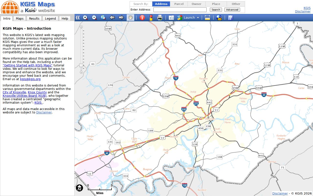
Once a result is selected, the map becomes the bridge between a house number, its parcel geometry, and the records that use a legal description instead of a postal line.
Farragut Street Record Terms
Names for an address can change across records. The short definitions below keep a Farragut street directory search from treating a postal label, map location, and legal land description as if they were identical.
- Parcel
- A mapped tract or unit identified by KGIS and used to connect assessment and map records.
- Situs address
- The property location used by parcel and tax authorities. It can differ from the owner’s mailing address.
- Plat
- A recorded map that describes subdivision lots, blocks, streets, or easements. It helps test whether two records concern the same land.
- Criss-cross directory
- A historical directory arranged by street or address rather than alphabetically by name. The exact local title and run should be checked at McClung.
A legal description may be a lot and block in a subdivision or a metes-and-bounds description. It often survives a postal change better than a mailing line. For a boundary or partial-conveyance question, compare the deed, plat, and KGIS report rather than relying on a street name alone.
Deed Trails Behind Farragut Streets
The Knox County Register of Deeds holds deeds, deeds of trust, releases, liens, powers of attorney, plats, easements, and other real-property instruments. Start with the current grantee or owner shown by KGIS, then give the office the legal description and approximate recording date. The Register says its earliest records are handwritten in the late 1700s, but a separately verified public online index cutoff was not found. The counter and copy-request route remain important.
To work backward, find the deed that conveyed the parcel to the current grantee, identify the grantor, and then find that grantor’s earlier acquisition for the same lot, subdivision, acreage, and exceptions. A grantor can own several parcels. Condominiums, right-of-way strips, and partial conveyances make a street-wide shortcut risky.
Copies are not all priced alike. The Register’s published schedule lists common recorded documents of up to two pages at $12, additional pages at $5, plats at $17, and certified copies at $1 per page. Check the published fee schedule before ordering, because a historical research request is not promised to be complete the same day.
Note: Recorded land documents establish legal interests, while KGIS is a discovery map and not a title-clearance opinion.
Farragut Street Permits and Map Layers
Farragut Building Permit Activity Reports are annual PDFs observed from 2013 through 2026. Download the year that fits the address history, then search the document for the street address, permit number, project description, or other labels printed in that report. A permit year can bracket construction, remodeling, an addition, or a recorded application. It does not prove that a named applicant lives at the site.
The Town also publishes map and GIS resources for zoning, subdivisions, wards, school zones, development projects, road plans, and other geographic context. Those materials help distinguish a town question from a broader Knox County parcel question. KGIS provides historic aerials from 1935 through the current 2026 layer, a long visual sequence that can show changes to roads, structures, and subdivision patterns without identifying occupants.
The captured Town maps page is a useful starting point for its zoning, ward, subdivision, road, and school-zone downloads.
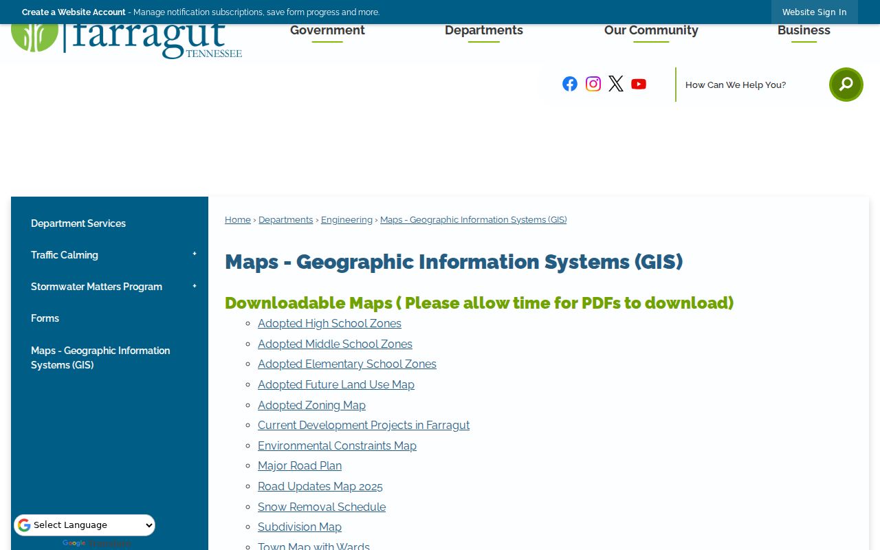
Pair a Town map with the parcel viewer when a road, subdivision, or ward matters to a street record, then verify the parcel’s legal connection with the appropriate custodian.
Farragut Street Names Across Eras
Farragut incorporated in 1980, so older records may use Knox County, Knoxville, Concord, Campbell Station, Kingston Pike, or a subdivision name instead of the town label. Kingston Pike and Campbell Station Road are especially important address axes. The absence of a Farragut-specific street-renumbering year in the reviewed sources is a reason not to guess at a conversion.
Match the parcel or legal description, cross streets, subdivision and lot, historic aerials, directory spelling, and deed parties. A ZIP mailing-line change is also not a parcel change. This cautious method works better than forcing an older directory address into a modern street name. The Knox County Archives and McClung reference collection are the next stops when the online trail ends.
Farragut Street Directory Voter Limits
The Tennessee voter lookup cannot produce a household list for a Farragut street. It requires Knox County, first name, last name, birth month, and birth year. A no-record response directs the user to verify the information and contact the local election commission. Use it only as a dated registration-match signal alongside parcel or historical evidence, because a registration address can be stale and an absent match does not prove that someone does not live nearby.
Knox County’s full voter-data request has a narrower route. The Election Commission says the USB file costs $40 and requires a certification that the request will be used for political purposes. It is available through the listed offices or by phone, rather than as an unrestricted street-browse tool. Do not reproduce sensitive identifiers or protected-address data from an individual result.
Requesting Farragut Street Records
When the map or portal does not reach the record needed, use the custodian that holds the series. The Town Recorder keeps Town minutes, ordinances, resolutions, contracts, deeds, easements, and other Town records. A Tennessee resident may make a Town public-record request by telephone, in person, or email to the Recorder or designee. The paper form is available at Town Hall reception and as a scanned PDF, so its field labels should be read directly rather than guessed.
The Town says it may provide records, deny the request in writing, or explain additional time within seven days; a requester may ask for a copy-cost estimate. County records outside an online span can also be reached through Knox County Archives by in-person, mail, email, or phone research. The Tennessee Public Records Act guidance explains specificity, inspection, copies, fees, and the state residency rule.
Archives holdings include permanent land, tax, marriage, divorce, probate, chancery, circuit, criminal, and Hamilton District records. Researchers sign in, may use cameras, and should plan around the reading room’s no-scanner rule. Regular copies cost $2 for the first page and $0.60 for each additional page; certified copies cost $5 for the first page and $0.60 after that. Juvenile and school records remain restricted.
Limits of a Farragut Street Directory
A Farragut street directory cannot establish a complete household. A current parcel owner is not every person at the property. Historical directories are selective and may use a business line, a prior street name, or a city-centered label. A registration search is not a public street browse, and a permit applicant or contractor is not necessarily an occupant or owner. DMV address data are restricted, and utility customer lists are not ordinary public records.
Lawful use. Use Farragut address records for personal, lawful research and verify them with the custodian. Do not use names, addresses, or map results to stalk, harass, intimidate, or harm anyone.
For a missing document, ask the specific custodian for the record series and date range, then preserve the request date and the office response with the address research log.